Distinguishing contributors
To publish to Google Maps and Street View, follow the Google Maps Image Acceptance and Privacy Policies. You'll always be able to tell who added the imagery to Google Maps.

Our content
Google–owned content credits "Street View" or "Google Maps." We automatically blur faces and license plates in our imagery.

Content from our users
When others contribute to Street View, their content is accompanied by a clickable/tapable account name, and in some cases, a profile photo.
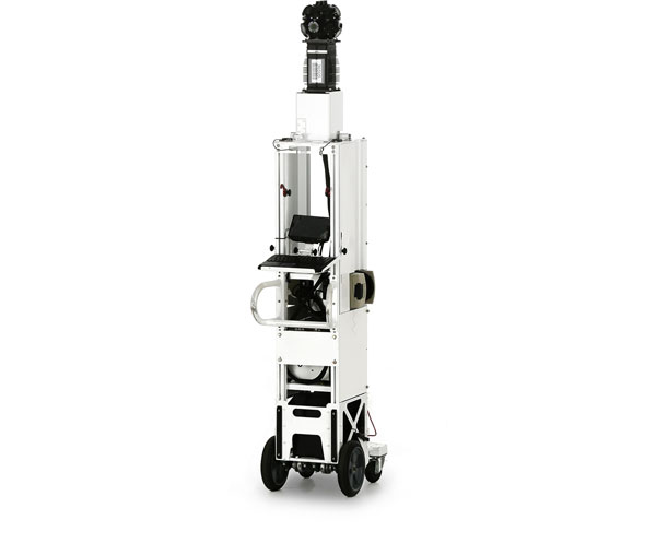
Google’s fleet
Street View Car
We've come a long way since our initial U.S. launch in 2007; today we've expanded our 360-degree panoramic views to include locations on all seven continents.

Street View Trekker
The Trekker enables Street View to feature more places around the world - places no car, trike, trolley or snowmobile can access. This wearable backpack is outfitted with a camera system on top, and its portability enables us to gather images while maneuvering through tight, narrow spaces or locations only accessible by foot. Our first collection using this camera technology was taken along the rough, rocky terrain of Arizona's Grand Canyon. Learn how to be the next Trekker

Street View Trolley
When a group of art-loving Googlers wanted to take Street View technology to museums around the world, we needed to develop a system that could easily fit through museum doorways and navigate around sculptures. This first foray indoors fit all the necessary equipment onto a smaller frame: a push-cart mounted with a camera system dubbed the Trolley. It has not only collected views from inside museums, but also other indoor locations like the White House and sports stadiums.
Street View Snowmobile
Another place we thought it'd be fun to take the Street View cameras is on the slopes. Over a few weekends using some 2x4s, duct tape, and extra hard drives wrapped in ski jackets to endure the freezing conditions, the team was able to successfully mount the Street View equipment on a snowmobile. Skiers, snowboarders and snowshoers can now explore Whistler Blackcomb Mountain and the bumpy snowy terrain of many ski resorts around.

Street View Trike
While we've been able to visit some beautiful places around the world with the Street View car, some of the most interesting and fun places aren't accessible by car. In order to reach some of the narrow alleyways in Europe, like those in Barcelona and Paris, a team of engineers built a tricycle-based camera system. This three-wheel pedi-cab with a camera system on top automatically gathers imagery as the operator pedals along. As a result, we've shared views from locations including theme parks, university campuses, zoos, Stonehenge, and UNESCO World Heritage sites across the globe.

Google’s publishing process
To share Street View imagery, our engineering team is hard at work behind the scenes. Here's a glimpse into what the team is doing to bring Street View to you.


Collecting Imagery
First off we need to actually drive around and photograph the locations to show in Street View. We pay close attention to many factors, including the weather and and the population density of various areas, to determine when and where can collect the best possible imagery.
Aligning imagery
To match each image to its geographic location on the map, we combine signals from sensors on the car that measure GPS, speed and direction. This helps us reconstruct the car's exact route, and even tilt and realign images as needed.
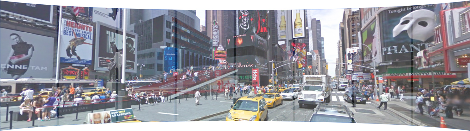
Turning photos into 360-degree panoramas
To avoid gaps in the panoramas, adjacent cameras take slightly overlapping pictures, and then we "stitch" the photos together into a single 360-degree image. We then apply special image processing algorithms to lessen "seams" and create smooth transitions.
Showing you the right image
How quickly the car's three lasers reflect off surfaces tells us how far a building or object is, and enables us to construct 3D models. When you move to an area in the distance, the 3D model determines the best panorama to show you for that location.