Blogroll
Topics

One of the exhibitions at the Cantor Arts Center is called Imagining the Oceans, curated by Margaret Cohen, who is the Andrew B. Hammon Professor French Language, Literature and Civilization.The exhibit is at the Marie Stauffer Sigall Gallery at the Cantor Art Center and runs through June 29, 2015.
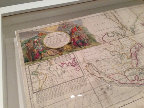
As part of that exhibition, on display, is one of the maps from the Glen McLauglin Map Collection of California as an Island, which is one of several collections at the Branner Earth Sciences Library:

Herman Moll 1719.
This remarkable map, considered as a state of the art at the time, was first displayed in 1719, the same year that Daniel Defoe published Robinson Crusoe. Defoe was part of Herman Moll's social circle and one can speculate on each others influences. Defoe was so impressed by this map that he included it in his sequel to Robinson Crusoe, called The Farther Adventures of Robinson Crusoe.
Here a few pictures from the walk-through of the exhibit:

A close up of the cartouche from the map.

Margaret Cohen explaining the exhibit.
The exhibit is up and free to the public until June 29, 2015 at the Marie Stauffer Sigall Gallery at the Cantor Art Center.


 Stanford University Home