
Stanford Lands
Satellite Map
Satellite Map
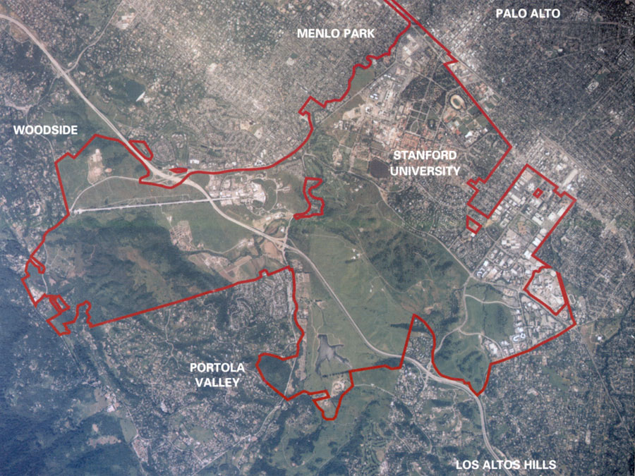
The size and varied topography of the 8,180 acres of foothills and plains Jane and Leland Stanford left to the trustees in the center of the San Francisco Peninsula provide a rare opportunity for comprehensive land use and resource management. About 60 percent of Stanford's land today remains open.
Governmental Jurisdictions
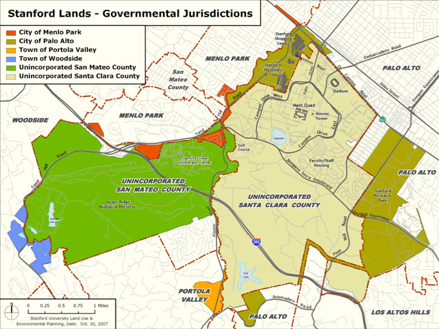
Governmental Jurisdictions
Redwood City Project Site
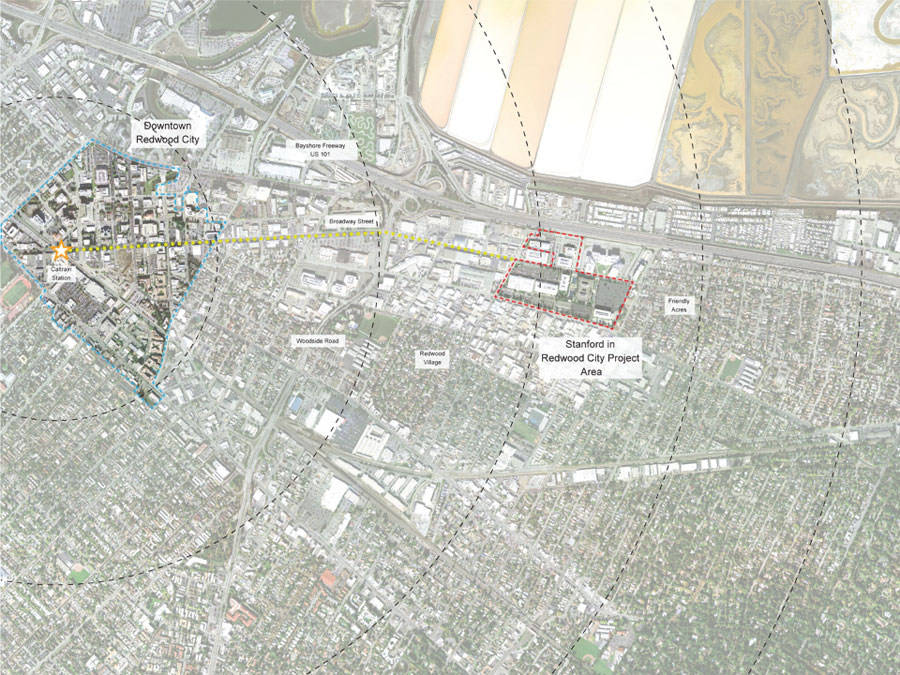
Redwood City Project Site
The Stanford University Redwood City project site is approximately 35 Acres of developed land, generally bounded by U.S. 101 on the north, Douglas Avenue on the west, Bay Road on the south, and Andrew Spinas city park, Redwood City Fire Station #11, and Rolison Road on the east. The project area is approximately seven miles from the Stanford University main campus and about one mile from downtown Redwood City.
The University is planning a future campus with sufficient flexibility to allow the phased development of academic, office, research and development, and medical uses. The new buildings are envisioned to allow for offices, research, and clinical uses, emphasizing attractive design and thoroughly sustainable features throughout the project. The project’s variety of uses will create a vibrant and varied Stanford presence in Redwood City.