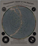
The Stunning Early Infographics and Maps of the 1800s

Objects from the David Rumsey Map Collection are featured in Atlas Obscura's Map Monday for January 30, 2017, features maps from John Emslie and James Reynolds.From Atlas Obscura's feature: "Have you ever wondered what the tallest active volcano is? Or wanted to compare the height of mountain peaks and the lengths of rivers around the world? So did John Emslie and James Reynolds.Between 1849 and 1851, topographical illustrator and engraver Emslie and publisher Reynolds designed scientifically based diagrams that measured out these geologic landforms and features in the 12-plate book Geological Diagrams. During the era, chartmakers helped increase accessibility and visibility of the latest scientific research by creating maps, illustrations, and figures depicting natural and man-made wonders around the world."Several of these maps are currently on display at the David Rumsey Map Center, as part of a new exhibit entitled "Views: Portraying Place and Space."Click here to visit the feature by Atlas Obscura.
