Blog topic: Geospatial

GIS Day @Stanford

GIS Day @Stanford is coming, November 16th!

November 10, 2016
by Mr. Stace D Maples

GIS Day is an annual celebration of geospatial technologies, held on the Wednesday of Geography week. The Stanford Geospatial Center uses GIS Day as an opportunity to connect Stanford researchers to the cutting edge of geospatial technologies, services and applications through talks, workshops and other activities. This year, we'll have analysts, developers and scientists from DigitalGlobe, Mapbox, CARTO, NASA, The National Geospatial Intelligence Agency and more, talking about their work to leverage geospatial data and technologies using machine learning, drones, satellite imagery, and historical data! 

Microscopy image by Juan G. Cueva and Miriam B. Goodman

SDR Deposit of the Week: Data on Exhibit

For nearly four years, the Stanford Digital Repository (SDR) has been home to the research outputs of scientists and scholars from across Stanford’s campus. But while those data files, videos, source code, microscopy images, survey results, maps and more have been discoverable and accessible through the Libraries’ online catalog, SearchWorks, it has been hard to get an overview of all the available data. Until now.

California Map Society / Rumsey Map Center Paper Award

California Map Society / Rumsey Map Center Paper Award

October 11, 2016
by G. Salim Mohammed

The California Map Society (CMS) is a founding friend of the David Rumsey Map Center. As partners, the Society will underwrite and facilitate the jurying and awarding of a Student Paper Award.

The award carries a cash prize of $1,000; an additional $400 will be used to fund travel to the northern and southern California speaker events where the award winner will present his or her paper under the auspices of the California Map Society. The deadline to submit is  February 17, 2017; the presentations will happen the week of April 24, 2017.

National Geospatial Advisory Group Holds Fall Meeting

October 2, 2016
by Julie Sweetkind-Singer

The National Geospatial Advisory Committee (NGAC) held its fall meeting at the National Conservation Training Center near Shepherdstown, West Virginia on September 27-28, 2016.  The NGAC is a Federal Advisory Committee (FACA) to the Federal Geographic Data Committee (FGDC).  The role of the NGAC is to provide advice and recommendations related to the national geospatial program and the development of the National Spatial Data Infrastructure.  Full minutes of the meeting, PowerPoints, and lightning talks will be available on the NGAC website shortly.  

Screen shot of an index map of an area in Japan. It shows an underlying map with rectangles overlayed, each of which represents a more detailed map of that area.

Index Maps in EarthWorks

September 27, 2016

Index maps, a kind of finding aid for navigating large sets of maps geographically, are now available interactively via EarthWorks. The Stanford University Libraries (SUL) have been publishing digitized maps online for many years, and in the past two years georeferenced maps, along with geospatial data, satellite imagery, and aerial photographs have been made more easily discoverable via EarthWorks, but index maps have posed special challenges. Thanks to cooperation between the staff of the Stanford Geospatial Center and the EarthWorks development team in Digital Library Systems and Services (DLSS), these maps are now more easily discoverable and navigable.

Screenshot of Claudia's Data Visualization

Visualizing History in Rio de Janeiro

The 2016 Summer Olympics are drawing lots of attention to Rio de Janeiro. But while most people are focused on the current games -- as well as current events, politics, and health issues that might impact the games -- others have been spending their time delving into the history of this more than 450 year-old city. And Stanford Libraries' own Claudia Engel couldn't resist dipping her hand in either.

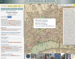
Authorial London screenshot

Authorial London: CIDR on writers in London in Kraków

June 29, 2016
by Glen Worthey

Authorial London, one of the latest and greatest in a series of interactive scholarly works developed in the Stanford Libraries, is going on the road this month.  Karl Grossner, research developer in the Center for Interdisciplinary Digital Research (CIDR) and principal architect and developer of Authorial London, will be traveling to Kraków, Poland to present the project at Digital Humanities 2016, the largest international conference in the DH world.  He'll be co-presenting with Kenny Ligda, an instructional designer in the Digital Learning Design Team of the Vice Provost for Teaching and Learning (VPTL) at Stanford.

Pages

RSS
accessibilityaccessprivsarrow-circle-rightaskus-chataskus-librarianbarsblogsclosecoffeecomputercomputersulcontactsconversationcopierelectricaloutleteventsexternal-linkfacebook-circlegroupstudyhoursindividualinterlibrarynewsnextoffcampusopenlateoutdoorpeoplepolicypreviousprinterprojectsquietreservesscannersearchstudysupportingtabletourstwitter-circleworking