
ePADD v4.0 beta 1 released!
We are thrilled to announce the beta release of ePADD v4.0! Read on for more details about this release, as well as updates on community engagement efforts and project staffing.
We are thrilled to announce the beta release of ePADD v4.0! Read on for more details about this release, as well as updates on community engagement efforts and project staffing.

Last week I spent 3 days at Google for their annual Google Earth Engine Summit, learning about new features and applications of their Google Earth Engine technology. If you haven’t seen Google Earth Engine, I encourage you to go to https://earthengine.google.com and use the signup link to get an account. It’s absolutely free for non-commercial use and it’s capabilities are pretty mind-blowing.
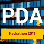
How can we best make sense of the digital strands and data that comprise a 21st century life? Explore innovative solutions to this challenge and others facing both individuals in the digital age, and scholars in the cultural heritage and digital humanities sectors, at the Personal Digital Archiving (PDA) 2017 Hackathon. The Hackathon is sponsored by Stanford University Libraries and will be held from March 31 - April 1, 2017 at the Jen-Hsun Huang Engineering Center on the Stanford University campus.

We are thrilled to announce the final release of ePADD v3.0, which introduces an entity merge interface, unique IDs, greater customization options, UI changes, and other fixes. Grab the new version and view the complete release notes here: https://github.com/ePADD/epadd/releases. Additional updates (including news about an upcoming hackathon and spring presentations) after the jump...
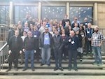
Geo4LibCamp is a hands-on meeting to bring together those building repository and associated services for geospatial data to share best practices, solve common problems, and address technical issues. We met at Stanford University for the second Geo4LibCamp unconference from January 30 until February 3, 2017. Nearly 50 attendees from 30 institutions participated in the main three day event, and about 20 attendees for the two day post-conference working sessions. The institutions were primarily academic research libraries -- Alberta, Arizona State, California State, Chicago, Colorado School of Mines, Colorado State, Colorado at Boulder, Connecticut State Library, Cornell, Data Curation Experts, Mapzen, Michigan, Minnesota, Moss Landing Marine Labs, Nebraska at Lincoln, New York U, Northwestern, Notre Dame, Princeton, Purdue, Rice, Stanford, UC Berkeley, UC Davis, UC Riverside, UC Santa Barbara, UC Santa Cruz, UCLA, Wisconsin – Milwaukee, and Yale.
We're excited to announce the release of ePADD 2.1, which contains a new customizable configuration file, an additional lexicon - microbiologist persona, and other minor fixes. You can grab the new version here: https://github.com/ePADD/epadd/releases.

How do we choose to document and share information about ourselves, our activities, and our communities? What happens to all of the data people create over their lifetimes? How can an information professional or researcher make sense of the various digital strands, remnants, and data that comprise a 21st century life?
Stanford University Libraries is thrilled to be hosting Personal Digital Archiving (PDA) from March 29-31, 2017. PDA 2017 will focus on current and emerging trends and scholarship in personal information management and personal digital archiving. The deadline to submit a proposal is Friday, November 25.

GIS Day is an annual celebration of geospatial technologies, held on the Wednesday of Geography week. The Stanford Geospatial Center uses GIS Day as an opportunity to connect Stanford researchers to the cutting edge of geospatial technologies, services and applications through talks, workshops and other activities. This year, we'll have analysts, developers and scientists from DigitalGlobe, Mapbox, CARTO, NASA, The National Geospatial Intelligence Agency and more, talking about their work to leverage geospatial data and technologies using machine learning, drones, satellite imagery, and historical data!