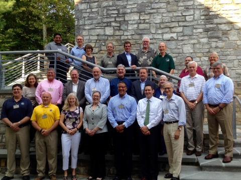
The National Geospatial Advisory Committee (NGAC) met outside Shepherdstown, West Virginia at the National Conservation Training Center on September 1-2, 2015. The full report of the meeting including the Powerpoints from the subcommittees and lightning sessions are available on the NGAC Website. The NGAC is a Federal Advisory Committee that reports to the Federal Geographic Data Committee (FGDC). Our role is to provide advice and recommendations related to the national geospatial program and the development of the National Spatial Data Infrastructure.
Jennifer Gimbel, the Principal Deputy Assistant Secretary for Water and Science, spoke to us at length about President Obama's visit to Alaska. She talked about the collaborative efforts by the government, the University of Minnesota's Polar Geospatial Center and Digital Globe to provide publicly available Digital Elevation Models (DEMs) of Alaska by mid-2016 and of the entire Arctic by the end of 2016. Read more about the initiative here. She also talked about the renaming of Mt. McKinley as Denali, which she stated was the name that has always been used by the Alaskans. She again requested that the NGAC produce a report that highlights our accomplishments over the last 6 years and lays out a roadmap of what we think will be important to support in the next 5 years.
Alan Rea, Hydrologist with the Core Systems Science team of the US Geological Survey, spoke to the group about the Open Water Data Initiative (OWDI). The goal of the initiative is to integrate the fragmented nature of the water information currently available into a national water data framework that allows researchers to be able to quantify "the availability, use, and risks to our national water resources." Three use cases are being developed to help inform the development of the Open Water Web: the National Flood Interoperability Experiment, the Drought Decision Support System, and the Spill Response Tool.
Stephen Lowe, the US Department of Agriculture Geospatial Information Officer, discussed the White House initiative to create a citizen science and crowdsourcing toolkit for the Federal Government. This initiative was announced on December 2, 2014. The Toolkit website is under development. The primary audience for this initiative will be Federal Agencies, but will be available to anyone interested in engaging citizens in scientific and societal problems. The NGAC will track these developments to understand where best our contributions are needed.
NGAC member, Keith Masback, Chief Executive Officer of US Geospatial Intelligence Foundation, gave an excellent talk on the state of geo-intelligence. He noted that "something really big is happening." That really big thing adds up to a revolution that equals the one we have gone through in last 10 years with online mapping and access to geospatial data (think Google maps, Google Earth, the National Map, etc.) The following factors are part of this new revolution in geospatial integration in society. Keith didn't know for sure where all of this would lead, but he assured us it would be game changing.
- We are creating a vast sensor web with our mobile devices. We are all carrying around supercomputers in our pockets and they are geolocation devices creating precision location data.
- We are at the beginning of something VERY different with remotely sensed information in all forms. Small satellites allow for agile development where one can iterate quickly because they are so cheap to create and put up. We also have widespread access to remotely sensed imagery with more to come through the Sentinel systems.
- Unmanned aerial systems are being used in different areas and use will continue to expand.
- The hurdles around broadband communication are going down and processing power on computers is going up with lower costs. Cloud storage cost is also going way down.
- The fastest growing segment on the geo-intelligence conference showroom floor is around data analytics. So much data is coming in, the need to understand it is critical.
- The most lucrative app development is now in spatial and location based services.
- It is expected that there will be 200% growth in the market for virtual and augmented reality by 2018.
- By 2020, it is expected there will be 50 billion connected devices through the Internet of Things.
The next and final NGAC meeting for the year will be via teleconference in December.
Here's the group at the NCTC with Jennifer Gimbel front and center.

Photo by Joshua Sweetkind-Singer


 Stanford University Home
Add comment