
Dedicated to advancing scholarly and public understanding of the past, present, and future of western North America, the Center supports research, teaching, and reporting about western land and life in the United States, Canada, and Mexico.
Weighing Californians' Appetite for Water Reductions

Lake Oroville reservoir in the summer of 2014 (California Department of Water Resources)
Buffeted by years of drought, Californians appear more ready than ever to make sacrifices to address the state's water challenges. According to a poll conducted in late August and early September, 54 percent of likely voters in California supported mandatory cutbacks in water supplies, and that "dealing with the state's water problems" topped their priorities for state government.
Poll respondents also showed high levels of support for a variety of water storage investments, from dams and reservoirs (70 percent in favor), desalination (81 percent), aquifer storage and recharge (89 percent) and stormwater recycling (91 percent). Support for recycled drinking water varied from 10 to 43 percent, with those who knew more about how the process works showing greater comfort with the idea.
 Bruce Cain, the Spence and Cleone Eccles Family Director of the Bill Lane Center for the American West, helped the Hoover Institution design the poll, which was administered by the polling firm YouGov. It surveyed 1,500 adult Californians from around the state between August 31 and September 11.
Earlier this week, Prof. Cain joined a panel at the Commonwealth Club in San Francisco to talk about the results. Concluding that voters had largely accepted California Governor Jerry Brown's water policy so far, he added a note of caution: "but the reality is that we've done so far is the easy stuff, and what we're facing is potentially a bigger and deeper problem." Cain cited two concerns: one, that California's water infrastructure was designed during what scientists now believe was an atypically wet 20th century, meaning that even normal conditions might be much drier than we realize; second, that rising temperatures due to climate change may undo the state's system of using winter snowpack as a "frozen reservoir."
"That system," he concluded, "is being undermined systematically and it's not clear that if we have to go to deeper cuts if we're going to find that level of public support."
Listen to the full audio of the event:
Ice Patches, Holes in the Ground, and Other Adventures in Yellowstone National Park
By Peter Salazar
B.A., History, 2015
Summer Intern at the Archeology Department, Yellowstone National Park
Read about our summer interns on the Out West student blog. Throughout the summer, the Center's interns and Research Assistants will be sending in virtual postcards, snapshots and reports on their summer work.

As much as I might have expected the pace of change and dynamism of my job in the Yellowstone Park Archaeologist’s office to slow in the final few weeks, no such thing actually occurred. I could hardly settle into a comfortable office routine before a new task or challenge would rise up and present itself for contemplation or resolution. My day-to-day task of updating, editing, and cleaning up the 2000 park site file records found regular and happy interruption in a number of other projects that continued to expose me further more to the world of archaeology and cultural resource management.
My experience working with GIS software, for example, allowed me to assist my supervisor in updating the park archaeological map, clearing out inconsistencies and filling in data that would make the rather unwieldy map to function in its capacity as a directory for the location and content of all of the park’s archaeological sites. I also had the opportunity to join my supervisor and a group of other natural and cultural resource management professionals on an educational excursion to the Beartooth Mountains (right next to the northeast entrance to the park) to explore the topic of ice patch archaeology, that is, scouring the rapidly melting ice patches of the high alpine regions of the vicinity for artifacts emerging after thousands of years. While we didn’t have any sensational finds on this particular excursion (aside from a well-preserved sheep skull and a spear shaft fragment), the exercise was a fascinating exposure to the issue of how cultural resource management is affected by such a far-reaching issue as global climate change.
And a description of my final few weeks in Yellowstone would be woefully lacking without a reference to my role participating in the Fishing Bridge construction monitoring. A scheduled update of a water main was taking place at Fishing Bridge, one of the principal intersections in the middle of the park, and an extremely sensitive archaeological site – it was there that the only pre-Columbian burials in the entire park were found. Another volunteer and I in the office, Melanie Langa, supervised the work and made sure that nothing of an archaeologically sensitive nature was being disturbed. It’s hard enough to methodically analyze stratigraphy, soil changes, and artifact density in a controlled excavation setting. But when your scientific instrument changes from a trowel to a backhoe, the task becomes exponentially more difficult. Unfortunately (or perhaps thankfully), we did not stumble across any buried settlements or treasure troves, but the exercise was nevertheless a fascinating lesson in geology and archaeological field methods.
I’m sad to go, of course. Yellowstone is a remarkable and breathtaking place to spend one’s summer. I became fond of saying to others that I would be more than happy to scrub toilets all summer, and I would still consider myself to have the emerged with a sweet deal for having been able to live in the park. To be able to live in the park and spend my time doing something that I loved and found interesting, however, makes an already dreamy situation that much better. I don’t know if I’ll end up pursuing a career in archaeology at this point, but this experience was nevertheless a fascinating introduction to the world of careful compromise, concession and dialogue that takes place in the stewardship of natural and cultural resources.
The Salton Sea: Natural or Not?

Panoramic view of the Salton Sea shore. (image: Akos Kokai via Flickr)
Daniel Polk is an anthropologist and postdoctoral scholar at the Center. His research looks at the politics of water in the borderlands of California. Here, he describes his research on the Salton Sea, the California's largest lake by area and a vast but rapidly changing body of water in the southern desert.
In the arid lowlands of the Imperial Valley lies the Salton Sea, California’s largest and perhaps most uncanny body of water. An inland sump, it is an enclosed drainage endpoint, a vast sheet of water surrounded by the heat and brittle aridness of the desert basin. With no outlet to the ocean, the lake’s concentration of salts and sediments only increases, mixed with fertilizers and pesticides from nearby agricultural runoff.
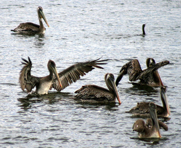
Image: Patty Mullins via Flickr
The lake is a habitat for hundreds of species of migrating birds, a vital stopover on the hemispheric migratory route known as the Pacific Flyway. Yet it remains a perilously balanced ecosystem. The lake teeters between fish population booms and massive fish die-offs, its shore carpeted with dried barnacles and fish bones. The Salton Sea also stands out for its recent history, arising only a century ago from the inundation of canals and levees along the Colorado River. In the press and most other accounts, the lake is nothing if not unnatural—a product of hastily-cut engineering, an out-of-place ecology. An examination of the Salton Sea however shows how this place resists ready categorization of “natural” or not.
The lake is a relatively young body of water. Its recent history attests to claims of its unusual nature. The Salton Sea began to rise when the Colorado River flooded through a shoddy irrigation canal in 1905. The full force of the river flowed into the Imperial Valley, led by gravity into the below sea-level basin until engineers dammed the flood in 1906. The river then broke through a levee, filling the basin until it was finally stopped in 1907. Many refer to the Salton Sea as an “accident of engineering.” However, it was not solely the result of slipshod canal works that resulted in the epic 1905-1907 flood. The Colorado River has frequently flooded the valley; geologists estimate that an ancient lake twice the size of today’s Salton Sea has periodically filled the basin for millennia. One wonders, if the levees had not been constructed in the first place then the river would have flooded into the basin on its own. If anything, the damming of the 1907 flood (and the continued irrigation water feeding the lake presently) have created a small-sized sea whereas in its place “Mother Nature” would have perhaps allowed the river to fill the basin to the brim.

Image: Travis S. via Flickr
Another aspect of the lake reflecting it unique attributes is perpetual environmental constraints. The Salton Sea is home to millions of salinity-resistant fish, which in turn support migrating birds. Yet the high “nutrient load” of the waters lead to occasional algae blooms, which starve fish of oxygen and lead to thousands of dead fish washing onto the shore. During such events, the lake produces hydrogen sulfide gas, an odor as unpleasant as rotten eggs. Even these challenges may not strictly merit the label of “unnatural.” Such processes of high salinity, nutrient load, algae blooms, fish die-offs, etc. are common to other lakes—what scientists call “eutrophication.” The lake’s most unusual, unsettling sight—dead fish covering the shore—is itself the product of a process documented in many other “natural” bodies of water. It is rather the scale and rate of these processes that is special to the Salton Sea, accelerated by unintended human impacts—what scientists call “cultural eutrophication.”

Image: Thomas Hawk via Flickr
Instead of seeking a conclusion on whether the lake is “natural” or not, it is more useful to ask what purpose does the Salton Sea serve, what relations and circumstances does it make possible? For the lake’s most pressing problem is political: how to raise the will to “save” the Salton Sea. Because of a historic “water transfer” between the Imperial Valley and San Diego, water that would normally drain into the lake has been diverted to San Diego and its suburbs. This water transfer is slowly draining the Salton Sea, and it is to go into full effect after 2017, marking the time after which the Salton Sea could shrink to half its size. As a result, dried-up lakebed would be exposed to harsh desert winds, kicking up fine sediments mixed with decades of accumulated pesticides into the polluted air. These dust storms could hinder the industry, agriculture and tourism of nearby Mexicali, Imperial Valley and Palm Springs, threatening the public health of over one million people in the United States and Mexico. The lake’s environmental restoration is not for the goal of simply restoring a “natural” habitat but of caring for a place which so many are connected to. The Salton Sea is part of an ecosystem which countless people and institutions now depend on.
The lake demonstrates that the “natural” is a fluid and not fixed term. Proponents of the Salton Sea often emphasize the natural qualities of the lake. If the lake is unnatural, then its decline can be more readily accepted by the public, yet if it is a natural place, then its restoration becomes a more urgent imperative, less easy to ignore for those in power. As a postdoctoral scholar at the Bill Lane Center, I will be continuing my research on the politics of the Salton Sea, placing a focus on the ways that its impacts cross political boundaries. This requires investigations into not only how people make sense of and negotiate water management, but also how people make sense of their world and define nature itself. To do so requires historicizing the present predicaments of the Salton Sea and highlighting the political nature of its ecological crisis.
Living History

Image: Tyler McIntosh and Sean Baumgarten get excited during an archival research trip to the U.C. Berkeley Earth Sciences Library.
By Tyler McIntosh
B.S. Earth Systems, 2016
Summer Intern at the San Francisco Estuary Institute
Read about our summer interns on the Out West student blog. Throughout the summer, the Center's interns and Research Assistants will be sending in virtual postcards, snapshots and reports on their summer work.
The day comes to a close with the furious ‘click-click’ of the camera and desperate yet muted riffling of yellowed archive pages. It’s 5 o’clock at the California Historical Society and our team of archival researchers from the San Francisco Estuary Institute is being booted out the door.
The San Francisco Estuary Institute (SFEI) is composed of three different programs: Clean Water, Environmental Informatics, and Resilient Landscapes. I am the intern for the Resilient Landscapes program, which works to create ecologically diverse landscapes that are resilient to climate change and human disturbance. Historical Ecology is perhaps the largest component of the program—the process of studying landscapes as they used to exist, intersect, and interact. The study of historical ecology, at least in the case of SFEI, involves the use of hundreds of first- and second-hand documents, compiled and cross-referenced in order to compose a vision of the historical landscape. Vision components include habitat, land use change, hydrology, geomorphology, and native species.
It is for one such study that I find myself suddenly standing outside the California Historical Society’s doors, blinking against the sunlight and San Francisco’s bubbling flow.
The society is but one of many treasure-troves of information that SFEI digs through for information on the numerous projects that the organization constantly juggles. An NGO known throughout the Bay Area for quality science at a landscape scale, SFEI works to define environmental problems, provide sound scientific research and analysis, and connect information with those in planning, management, and policy-making positions.
Just like SFEI itself, over the past few weeks I’ve juggled work on a number of different projects. From GIS data entry and copy editing reports to researching the Pacific pocket mouse (an endangered species historically found in the lower Tijuana Valley in San Diego County) and continued historical ecology database searches and archive visits, I’ve gotten a chance to experience many of SFEI’s modes of communication and research. It’s been fascinating to see the massive scale of research outside of a strictly academic context.
I’ve also greatly appreciated the opportunities I’ve been given to learn about NGO functioning, project coordination, and the work that different organizations are doing in the Bay Area; between brown-bag lunches from partner organizations, sitting in on meetings, and being involved in and around the office, it’s nearly impossible NOT to learn something new.
Although my heart, lungs, and legs yearn for the open air of the mountains where I grew up, I’ve taken it upon myself to explore the Bay Area as best I can with what free time I’ve been able to squeeze from my busy days. My few short weeks of living in Berkeley have already shown me parts of California that I hadn’t seen before: the mirror of the bay cradled between golden-grassed hillsides, Mt. Diablo’s skin-frying sunbeams and sweeping vistas, San Francisco’s delights, Berkeley’s many hidden nooks and crannies, and so much more.
I look forward to continuing my summer with SFEI, learning more about the company’s internal workings and analysis process, and getting a chance to work on a variety of projects; in particular, historical ecology research on the Walnut Creek watershed and Mission Bay in Southern California.
A Demographic Portrait of State Legislators

Image: Image: one of the products of our study will be an interactive map with current state-by-state legislator demographics
By Michael Gioia
Intern, the National Conference of State Legislatures
Read about our summer interns on the Out West student blog. Throughout the summer, the Center's interns and Research Assistants will be sending in virtual postcards, snapshots and reports on their summer work.
In the last month, I have taken the plunge into a deep study of legislative demographics. While this is a long-term project that still won’t be completed when I leave NCSL, the ultimate product is still quite exciting: we are producing a comprehensive study that will not only longitudinally track changes in the demographics of state legislators, but also compares those demographics to those of the U.S. Congress and the national population as a whole.
I’ve been analyzing a wide variety of data, as we’re interested in everything from race and gender to the occupations and religion of state legislators. Of course, with such an ambitious project, there can be some bumps along the road. For instance, the U.S. Census and State Legislatures often use difference demographic categories, so we have spent a good deal of time deciding how to bridge those differences.
Despite the occasional challenge, working on this research project has been a very illuminating experience for me. My big goal for this summer was to get a better sense of the differences between doing research in university and non-university environments. While I have worked on similar subjects as a Research Assistant in Stanford’s Political Science Department, my project at NCSL has still proven to be a novel experience for me, just given the different culture and expectations. To begin with, much of our work has very clear stakeholders, who are paying dues in exchange for the research we provide. This being the case, projects at NCSL often require a quicker turnaround, along with a concise and direct report of findings. For me, this has produced a noticeable contrast with my time doing research at Stanford, where projects have a less strict schedule for deadlines, and consequentially are able to delve deeper into issues for the sake of intellectual curiosity. Given that I’m contemplating a career in research, understanding this difference in environments is enormously useful for me.
Another goal of mine for the summer was to better understand Colorado’s history and culture. I had never been to Colorado prior to my arrival this summer, and I hoped to use my ten weeks here to learn about and appreciate this part of the country. At this point, I think it’s safe to say that I’ve succeeded. In addition to exploring Denver, along with other parts of the state, I’ve learned a great deal about the history of the area, from its early growth dating back to an extension of the transcontinental railroad, to its contemporary challenges as Denver confronts unprecedented population growth. This history is not only interesting – it has helped me feel more connected to my home for the summer. I’m looking forward to my last few weeks here. I’m excited to see the product of all of my work grow closer towards completion, but I’m also getting ready to head home. With all of my work and adventures, I’ll need some time to rest!
A Trail Takes Shape in the Pacific Northwest

Pictures from the Pacific Northwest Trail Association's Instagram account
In the wilds of the Northwest, a trail is taking shape. Designated by an act of Congress in 2009, the Pacific Northwest Scenic Trail winds 1,200 miles from Glacier National Park in Montana to Cape Alava on Washington's Pacific coast. Along the way, the trail passes through the Rocky Mountains, Eastern Washington, the North Cascades, and the Olympic Mountains. It crosses three national parks and seven national forests. Like such well-known western routes as the Pacific Crest Trail, it passes largely through public lands managed by states, tribes, and agencies of the federal government. Some of the trail also crosses private lands, predominantly owned by timber companies.

But while the general route of the trail is largely set, many decisions will need to be made to refine the trail's scenic, historical, and environmental impact. For this reason, the trail's managing agency, the U.S. Forest Service, has decided to convene an advisory council to oversee its development.
We are pleased to announce that Bill Lane Center for the American West's founding former director David M. Kennedy was selected to join the trail's advisory council by Secretary of Agriculture Tom Vilsack. Kennedy, a son of the Pacific Northwest and avid outdoorsman, says that he is thrilled to be involved with the committee, which will meet regularly starting in October 2015.
"I grew up in the Pacific Northwest and have back‐packed and horse‐packed much of the proposed route," says Kennedy. "I was honored to be asked to join the advisory committee, and hope to contribute some historical perspective to its development – and to be a voice for accessibility for all users, given my long‐time association with Environmental Traveling Companions (ETC), a San Francisco‐based service organization for people with disabilities."

The Pacific Northwest Trail is the newest of 11 nationally designated scenic trails. The first was the Appalachian Trail, completed in 1937. Other western scenic trails include the Pacific Crest Trail (1968), Continental Divide Trail (1978), and the Arizona Trail (2009). Additionally, the federal government has designated national historical trails like the Oregon, California, Nez Perce, Pony Express, Santa Fe, El Camino, and Mormon Pioneer Trails. The historical trails are so designated because they "closely follow a historic trail or route of travel of national significance," according to the Bureau of Land Management, which stipulates that "their designation identifies and protects historic routes, historic remnants, and artifacts for public use and enjoyment."
The scenic trails, by comparison, "are extended trails that provide maximum outdoor recreation potential and for the conservation and enjoyment of the various qualities." It is these qualities that trail managers at the Forest Service and the trail's advisory council will need to assess and balance these with right-of-way and accessibiliity questions, community interests and impacts, and other concerns.
For more information on the Pacific Northwest Scenic Trail, please see the U.S. Forest Service and the Pacific Northwest Trail Association.
Kathy Zonana Moves Into News
Photograph: L.A. Cicero, Stanford News Service
We're both sad to say goodbye to our Associate Director, Kathy Zonana, and pleased to see her move on to an editing position at Stanford Medicine magazine. For three years, Kathy has kept the Center running, from working with the Advisory Council, coordinating our 10-year review and handling some major gifts, to hiring staff and postdocs, to helping launch our first full-term undergraduate course, The American West. Not to mention putting on her sneakers and keeping our spirits up through several 20-mile hikes from Stanford to the Sea.
But above all, from my perspective, was Kathy's steady hand on public outreach work like our film series, guest speakers, book publications, and journalism projects. Her judgment and editing skills were a valuable backstop to our media projects, and she was an excellent ambassador for the Center at public events. Trained as a lawyer but with years of editorial experience, Kathy is a fine writer and a wonderful colleague, so while we will miss her dearly, we are glad to know that she is, to borrow a phrase from a 2012 Stanford News Service article featuring Kathy, "moving into news." We look forward to seeing her work in Stanford Medicine and seeing her around the Farm.
We will be posting more information about our staffing in the coming weeks, but in the meantime, please join us in wishing Kathy the very best for her next steps.
An 'Ambitiously Multidisciplinary Course' on the West

Frederic Remington's "Aiding a Comrade" from 1890 (Museum of Fine Arts, Houston/Public Domain)
The July/August issue of Stanford Magazine features the Center's undergraduate course The American West, which was offered for the second time during the spring quarter. The course, co-taught by professors from five different departments,"may be the most ambitiously multidisciplinary course on this or any other campus," says David M. Kennedy.
If you pick classes as if you're choosing from menus, The American West is where you go for fusion. Besides blending history, geography and politics with art and culture, the spring course brings together five noted professors in what amounts to an interdisciplinary banquet.
Bruce Cain is from political science, Shelley Fisher Fishkin from English, David Freyberg from civil and environmental engineering, David M. Kennedy from history, and Alexander Nemerov from art and art history. Each lecture session is usually apportioned among three of the professors, but there are periodic discussion segments in which they all participate.
The course will be offered again in the spring of 2016. More information is available on our website.
Back Issues: Finding Unexpected Currency in the Pages of an Iconic Western Magazine

Sunset magazine covers from June 1978, July 1976 and July 1979. (Images via Stanford University Library)
Bill Marken is the former editor-in-chief of Sunset magazine, and other print and digital publications. He spent a year at the Bill Lane Center for the American West as a visiting scholar, researching a book on Sunset's influence on the West's postwar boom period. Here, Bill reflects on his time at Stanford and how it shaped his research.
When I first came to the Bill Lane Center for the American West for what turned out to be an eye-opening year, I wrote that I was developing a “narrative history of Sunset Magazine’s great success and influence in the West following World War II.” I was intending a book that focused on the groundbreaking period of the magazine’s two chief editors who preceded me: Walter Doty and Proctor Mellquist. They, along with Laurence and sons L.W. “Bill” and Mel Lane of course, were there for the 1940s-1960s when Sunset vividly reflected and also powerfully shaped the distinctive lifestyle emerging during a time of unprecedented western population growth, prosperity, and creativity.
My year at the Center helped turned that thinking around. True enough, Sunset’s postwar Doty/Mellquist period was extremely fertile, and the pages of the magazine were full of the new: midcentury modernism, leafy suburbs, back yard pools and barbecues, road trips with the station wagon, early ancestors of nachos. But the feedback and inspiration I got from the Center’s workshops, a public seminar, and discussions with colleagues gave me a deeper appreciation and understanding of the time I was at Sunset.
During my 32 years on the magazine (1964-1996, the last 15 years as editor in chief), Sunset also ventured into new ground – the threats to the West’s precious natural resources and the pressures of escalating population growth and development. At the Bill Lane Center last year, I was struck with how much of Sunset’s early environmental efforts overlapped with the Center’s current activities and how relevant some of those same complex issues are today.
From the late 1960s and well into the 1980s, the pages of the magazine reflected the changing West: the battle over Redwood National Park, alternatives to DDT in home gardens, UC Santa Cruz’s organic garden, threats to Tahoe, and much more. Sunset also dived deeply into two especially critical subjects that are getting considerable attention at the Center today: the California Coast and water.
The California Coastal Plan was triggered by a grass-roots storm that put an initiative on the 1972 ballot to protect the length of the coast. Mel Lane became the first coastal commissioner in 1976. At the time Mel was running Sunset’s book division (with Bill in charge of the magazine), and around the magazine we welcomed his involvement. Mel was extremely well liked and universally trusted, and his role on the commission didn’t affect what we did in the magazine. We approached the subject with a business-as-usual attitude (the last thing Mel would want would be articles that compromised his position or glorified it), mainly with articles advising readers on where and how to appreciate the coastal areas that were at stake.

Redwood National Park on California's northwest coast, established in 1968. (Image: Tim Parkinson via Flickr)
The plan and commission were groundbreaking in their scope and became a model used throughout the nation – even today.
These days at the Bill Lane Center for the American West, a team including Bruce Cain, Todd Holmes, and Iris Hui are unearthing the California Coastal Plan’s origin, impact, and ongoing lessons for the future. I will follow their work closely.
Another large issue of that same period has even more relevance today. The drought of 1976-77 – short by today’s standards, extremely severe by any standard – shocked all Californians. On the magazine, we responded in the way we knew would offer readers the most help around their homes: with how-to articles on drip irrigation, mulching, new plumbing solutions, and other practical solutions for conserving water. Probably Sunset’s main contribution was offering readers a new palette of drought-tolerant plants to work with. These plant lists were reprinted by the hundreds of thousands for East Bay Municipal Utility District customers; they were updated during the next drought in the late 1980s. As publisher of Sunset magazine, Bill Lane himself helped the editors give readers a heads-up on the water crises ahead. Through his service on the board of California Water Service, he learned early on about the University of Arizona’s tree-ring research that demonstrated historic patterns of long-term, repeated droughts. A 1970s Sunset article about the research warned of even more droughts looming in the future. In hindsight, though, I have to say that we could have done more to explain the larger forces at work: that California’s water supplies and policies were reaching their limits, not prepared for a future of water crises that loomed ahead.
Those larger forces are just what the Center and its Water in the West project – a collaboration with the Stanford Woods Institute – are facing head-on with initiatives such as “Understanding California’s Groundwater” and “Ensuring Water for Nature & People.”
As I chip away at my own book project, I now envision it stretching beyond the postwar boom into the era when we began to recognize and address environmental limits.
Thanks to the Bill Lane Center – Bruce Cain, Kathy Zonana, Geoff McGhee, Todd Holmes, Nick Bauch, Iris Hui, Janny Choy, Kathy Montgomery, and Minh Chau Ho – for so kindly welcoming me and expanding my perspective.

